
About the province
Geography and climate
Where the province lies, the shape of its land, its weather, and the natural resources it protects.
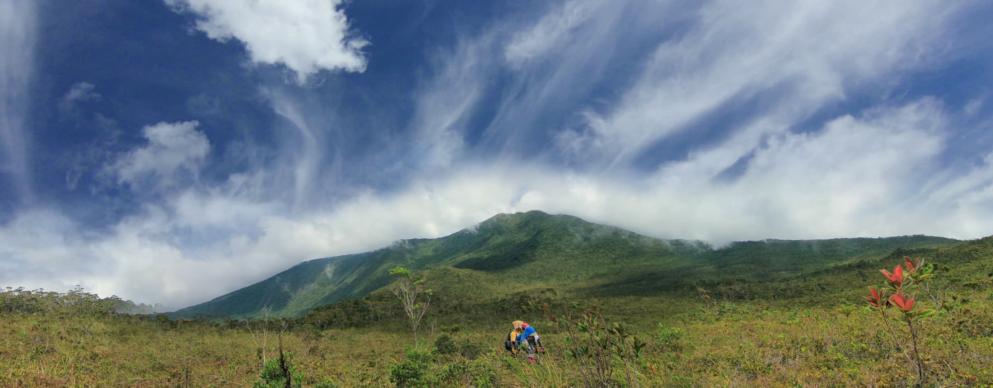
Photo: Provincial Information Office, Provincial Government of Davao Oriental · Philippine government work (RA 8293 Sec. 176)
Geographic location
Location and boundaries
Davao Oriental is a province of Region XI (Davao Region) in southeastern Mindanao. It is bordered by Agusan del Sur and Surigao del Sur to the north, Davao de Oro to the west, the Philippine Sea (Pacific Ocean) to the east and Davao Gulf to the southwest. It comprises the City of Mati, the capital, and 10 municipalities, subdivided into 183 barangays. PhilAtlas, citing PSA, lists a land area of 5,679.64 square kilometres. The provincial government describes Pusan Point in Barangay Santiago, Caraga, as the easternmost point of the Philippines.
Sources: PhilAtlas, Davao Oriental profile (secondary; states figures are derived from PSA); PSA, PSGC 2Q 2026 Publication Datafile (30 June 2026) - fetched via Internet Archive because psa.gov.ph blocks automated requests; Provincial Government of Davao Oriental, "Facts About Davao Oriental" (credited to DTI Provincial Office; archived 2022-06-20); Provincial Government of Davao Oriental, "History of Davao Oriental" (archived 2022-02-11).
Public record · pending validationSource: PhilAtlas, Davao Oriental profile (secondary; states figures are derived from PSA)Last updated:
Location in figures
Area, extent and boundaries
| Fact | Value | Source and reference period |
|---|---|---|
| Total land area | 5,679.64 km²Equals the sum of the 11 LGU areas on PhilAtlas. CONFLICT: the former provincial website states 5,164 km2 (Provincial Profile / Facts pages) and 5,146 km2 (History page); polygon area of the boundary dataset sums to about 4,996 km2. No PSA/LMB primary document was fetched. | Public record · pending validationSource: PhilAtlas, Davao Oriental profile (secondary; states figures are derived from PSA)Reference period: 2013 (as labelled by PhilAtlas)Last updated: |
| Bordering provinces | Agusan del Sur, Surigao del Sur, Davao de OroPhilAtlas: "bordered, clockwise from the North, by Agusan del Sur, Surigao del Sur, Philippine Sea, Davao Gulf, and Davao de Oro". The archived provincial page gives Agusan del Sur and Surigao del Sur to the north and "Davao Province" to the west. | Public record · pending validationSource: PhilAtlas, Davao Oriental profile (secondary; states figures are derived from PSA)Last updated: |
| Bordering bodies of water | Philippine Sea (Pacific Ocean), Davao GulfArchived provincial "Facts" page: "bounded by the Pacific Ocean in the East ... Davao Gulf and Celebes Sea in the South". | Public record · pending validationSource: PhilAtlas, Davao Oriental profile (secondary; states figures are derived from PSA)Last updated: |
| Coastline length (km), as stated by the province | 513.2 kmPage wording: "The longest coastline of about 513.2 kilometers". Not verified against NAMRIA. | Public record · pending validationSource: Provincial Government of Davao Oriental, "Davao Oriental's Competitive Advantages" (credited to DTI Provincial Office; archived 2022-06-20)Reference period: as archived 2022Last updated: |
| Easternmost point | Pusan Point, Barangay Santiago, CaragaDescribed by the provincial page as the easternmost point of the Philippines. | Public record · pending validationSource: Provincial Government of Davao Oriental, "History of Davao Oriental" (archived 2022-02-11)Last updated: |
| Geographic extent (west, south, east, north; WGS84) | 125.94412, 6.26928, 126.60496, 8.00207 | Public record · pending validationSource: faeldon/philippines-json-maps v1.1.1 (PSGC 3Q 2026; OCHA COD-AB, NAMRIA/PSA) - computed from public/geo/province.geojsonReference period: PSGC 3Q 2026 boundariesLast updated: |
| Geographic centroid (longitude, latitude; WGS84) | 126.29823, 7.25136 | Public record · pending validationSource: faeldon/philippines-json-maps v1.1.1 (PSGC 3Q 2026; OCHA COD-AB, NAMRIA/PSA) - computed from public/geo/province.geojsonReference period: PSGC 3Q 2026 boundariesLast updated: |
Topography
The shape of the land
The Mount Hamiguitan Range forms a north-south mountain ridge along the Pujada Peninsula, with an elevation range of 75 to 1,637 metres above sea level within the wildlife sanctuary, according to UNESCO. The provincial government states that the province has a coastline of about 513.2 kilometres. A verified figure for the province's highest point was not found.
Sources: UNESCO World Heritage Centre, Mount Hamiguitan Range Wildlife Sanctuary (List no. 1403) - fetched via Internet Archive snapshot of 2026-10-31; Provincial Government of Davao Oriental, "Davao Oriental's Competitive Advantages" (credited to DTI Provincial Office; archived 2022-06-20).
Public record · pending validationSource: UNESCO World Heritage Centre, Mount Hamiguitan Range Wildlife Sanctuary (List no. 1403) - fetched via Internet Archive snapshot of 2026-10-31Last updated:
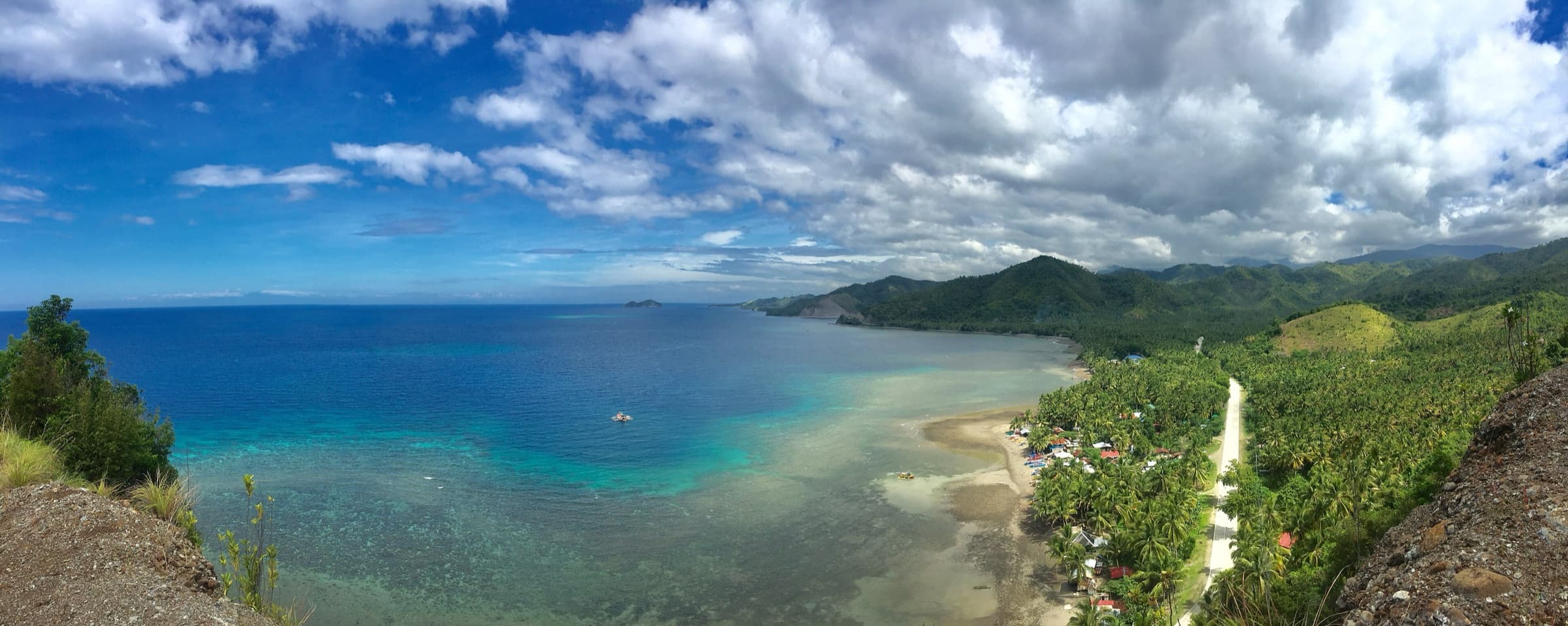
Photo: VanzSars · CC BY-SA 4.0
Climate
Climate
A Department of Agriculture (AMIA) climate-risk assessment classifies the province under Type IV climate, in which rainfall is more or less evenly distributed throughout the year, and projects average rainfall rising slightly from 2,136 millimetres to 2,234 millimetres by 2050. An older provincial investment page instead describes a short dry season with pronounced rainfall from the end of the year until March; the two descriptions have not been reconciled against a PAGASA publication.
Sources: Department of Agriculture - AMIA, Technical Report "Climate Risk Vulnerability Assessment in Davao Oriental" (Tabanera, Catalan, Aceres); Provincial Government of Davao Oriental, "Davao Oriental's Competitive Advantages" (credited to DTI Provincial Office; archived 2022-06-20).
Public record · pending validationSource: Department of Agriculture - AMIA, Technical Report "Climate Risk Vulnerability Assessment in Davao Oriental" (Tabanera, Catalan, Aceres)Last updated:
| Fact | Value | Source and reference period |
|---|---|---|
| Climate type (Modified Corona classification) | Type IVDA-AMIA report: "The province fall under Type IV which means rainfall is more or less evenly distributed throughout the year." CONFLICT/CAVEAT: the archived provincial page describes a "short dry season and very pronounced rainfall towards the end of the year until March". No PAGASA page naming the province was fetched. | Public record · pending validationSource: Department of Agriculture - AMIA, Technical Report "Climate Risk Vulnerability Assessment in Davao Oriental" (Tabanera, Catalan, Aceres)Last updated: |
Natural resources
Natural resources and protected areas
The Mount Hamiguitan Range Wildlife Sanctuary, which straddles San Isidro, Governor Generoso and the City of Mati, was inscribed on the UNESCO World Heritage List in 2014 under criterion (x). The property covers 16,923.07 hectares with a 9,729.47-hectare buffer zone. UNESCO records 1,380 species there, 341 of them endemic to the Philippines, including the Philippine eagle and the Philippine cockatoo, and a mossy-pygmy ("bonsai") forest at its highest elevations. The provincial government also lists agricultural, forestry, marine and mineral resources, naming nickel, chromite, manganese, copper, cobalt, silver, gold, iron, silica, magnesite and limestone among its mineral deposits.
Sources: UNESCO World Heritage Centre, Mount Hamiguitan Range Wildlife Sanctuary (List no. 1403) - fetched via Internet Archive snapshot of 2026-10-31; Provincial Government of Davao Oriental, "Davao Oriental's Competitive Advantages" (credited to DTI Provincial Office; archived 2022-06-20).
Public record · pending validationSource: UNESCO World Heritage Centre, Mount Hamiguitan Range Wildlife Sanctuary (List no. 1403) - fetched via Internet Archive snapshot of 2026-10-31Last updated:
| Fact | Value | Source and reference period |
|---|---|---|
| UNESCO World Heritage property | Mount Hamiguitan Range Wildlife Sanctuary | Public record · pending validationSource: UNESCO World Heritage Centre, Mount Hamiguitan Range Wildlife Sanctuary (List no. 1403) - fetched via Internet Archive snapshot of 2026-10-31Last updated: |
| Year inscribed on the World Heritage List | 2014 | Public record · pending validationSource: UNESCO World Heritage Centre, Mount Hamiguitan Range Wildlife Sanctuary (List no. 1403) - fetched via Internet Archive snapshot of 2026-10-31Last updated: |
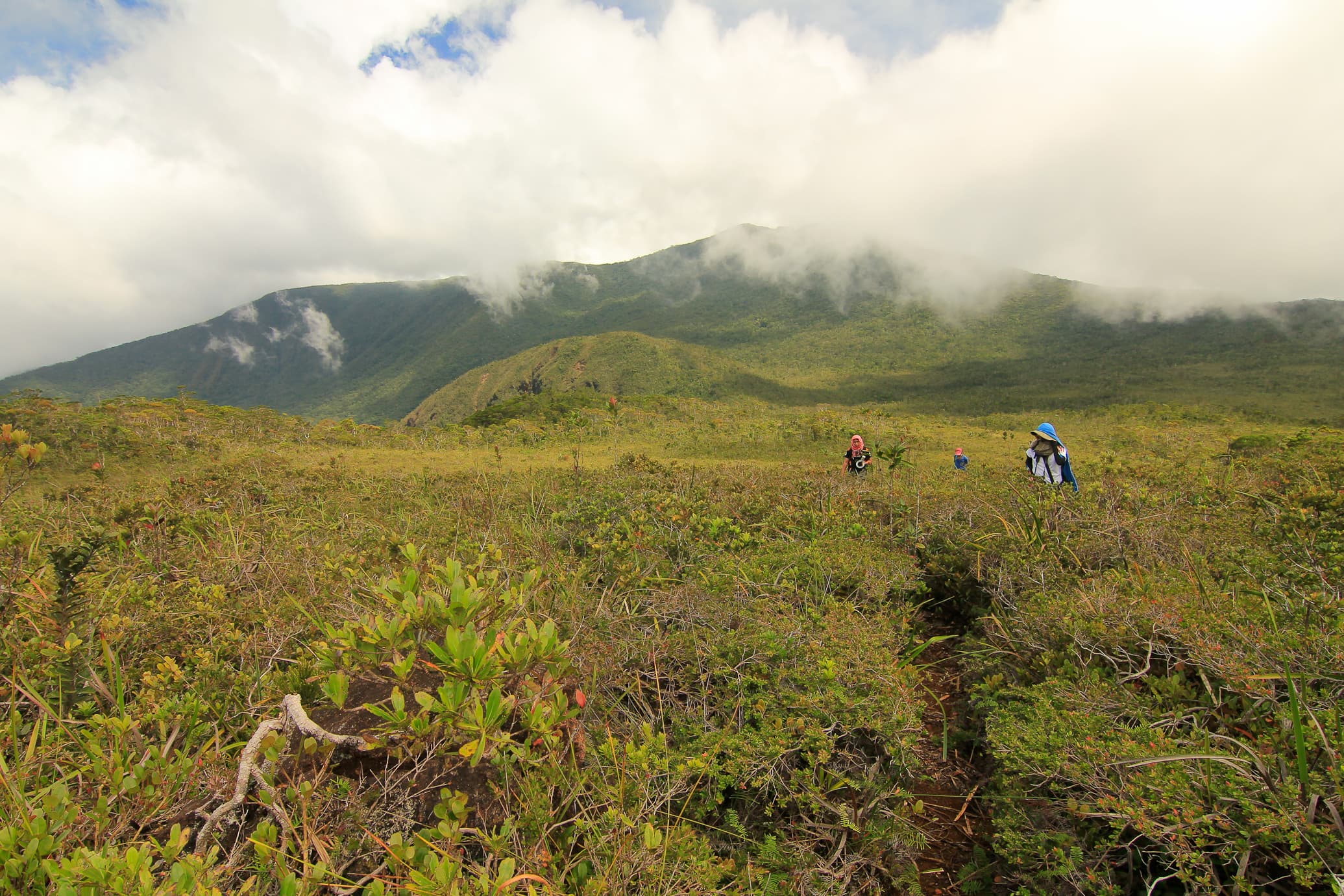
Photo: Provincial Information Office, Provincial Government of Davao Oriental · Philippine government work (RA 8293 Sec. 176)