
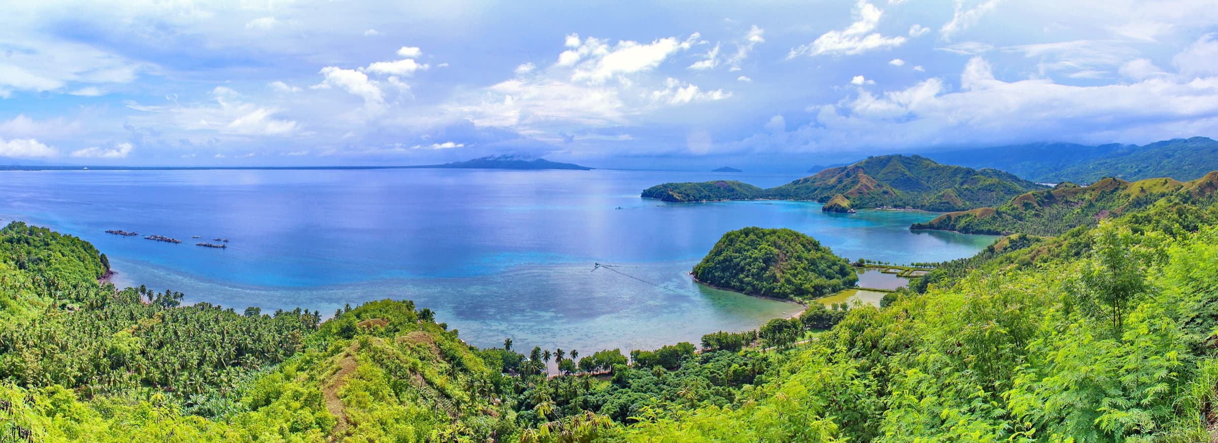
About the province
Davao Oriental
Region XI (Davao Region), Mindanao · Capital: City of Mati
Photo: Michael E. Peligro · CC BY-SA 4.0
Key facts
The province in figures
Each figure states its source, the period it refers to and when this record was last updated. Figures from public records are labelled until the responsible provincial office validates them.
- Population, 2024 Census of Population
- 590,042
Public record · pending validationSource: PSA, PSGC 2Q 2026 Publication Datafile (30 June 2026) - fetched via Internet Archive because psa.gov.ph blocks automated requestsReference period: 2024Last updated:
- Population, 2020 Census of Population and Housing
- 576,343
Public record · pending validationSource: PSA, PSGC 1Q 2025 Publication Datafile (31 March 2025) - fetched via Internet ArchiveReference period: 1 May 2020 (census date per PhilAtlas)Last updated:
- Total land area
- 5,679.64km²
Public record · pending validationSource: PhilAtlas, Davao Oriental profile (secondary; states figures are derived from PSA)Reference period: 2013 (as labelled by PhilAtlas)Last updated:
- Persons per square kilometre, 2024 (derived)
- 103.9per km²
Public record · pending validationSource: PSA, PSGC 2Q 2026 Publication Datafile (30 June 2026) - fetched via Internet Archive because psa.gov.ph blocks automated requestsReference period: 2024Last updated:
Sources differ on the province’s land area
Equals the sum of the 11 LGU areas on PhilAtlas. the former provincial website states 5,164 km² (Provincial Profile / Facts pages) and 5,146 km² (History page); polygon area of the boundary dataset sums to about 4,996 km². No PSA/LMB primary document was fetched.
This website shows the PhilAtlas figure because it equals the sum of the eleven city and municipal areas used elsewhere on the site. It will be replaced with the figure certified by the Provincial Assessor’s Office or the Land Management Bureau once supplied.
| Fact | Value | Source and reference period |
|---|---|---|
| Capital | City of MatiRA 4867 Sec. 2 names the Municipality of Mati as capital; PSGC Summary of Changes records Mati as a city under RA 9408. | Public record · pending validationSource: PSA, PSGC 2Q 2026 Publication Datafile (30 June 2026) - fetched via Internet Archive because psa.gov.ph blocks automated requestsReference period: PSGC 2Q 2026 (Status: Capital)Last updated: |
| Region | Region XI (Davao Region) | Public record · pending validationSource: PSA, PSGC 2Q 2026 Publication Datafile (30 June 2026) - fetched via Internet Archive because psa.gov.ph blocks automated requestsReference period: PSGC 2Q 2026Last updated: |
| Island group | Mindanao | Public record · pending validationSource: PSGC API (psgc.gitlab.io)Last updated: |
| Provincial income classification | 1st | Public record · pending validationSource: PSA, PSGC 2Q 2026 Publication Datafile (30 June 2026) - fetched via Internet Archive because psa.gov.ph blocks automated requestsReference period: DOF Department Order No. 074.2024Last updated: |
| Law creating the province | Republic Act No. 4867"An Act Creating the Provinces of Davao del Norte, Davao del Sur and Davao Oriental". Original municipalities named for Davao Oriental: Lupon, Governor Generoso, Mati, Manay, Caraga, Banganga [sic] and Cateel. | Public record · pending validationSource: Republic Act No. 4867, "An Act Creating the Provinces of Davao del Norte, Davao del Sur and Davao Oriental" (The Lawphil Project)Last updated: |
| Date the creating law was approved | May 8, 1967The former provincial website states the first governor served from 1 July 1967, and a 2022 provincial executive order title refers to 1 July 2022 as the "55th Araw ng Davao Oriental". | Public record · pending validationSource: Republic Act No. 4867, "An Act Creating the Provinces of Davao del Norte, Davao del Sur and Davao Oriental" (The Lawphil Project)Last updated: |
| Legislative (congressional) districts | 2Source page text reads "District 11" for the second district (typographical for II). Composition not re-verified against a House of Representatives or COMELEC page. | Public record · pending validationSource: Provincial Government of Davao Oriental, "Facts About Davao Oriental" (credited to DTI Provincial Office; archived 2022-06-20)Reference period: as archived 2022Last updated: |
| Coastline length (km), as stated by the province | 513.2 kmPage wording: "The longest coastline of about 513.2 kilometers". Not verified against NAMRIA. | Public record · pending validationSource: Provincial Government of Davao Oriental, "Davao Oriental's Competitive Advantages" (credited to DTI Provincial Office; archived 2022-06-20)Reference period: as archived 2022Last updated: |
| Bordering provinces | Agusan del Sur, Surigao del Sur, Davao de OroPhilAtlas: "bordered, clockwise from the North, by Agusan del Sur, Surigao del Sur, Philippine Sea, Davao Gulf, and Davao de Oro". The archived provincial page gives Agusan del Sur and Surigao del Sur to the north and "Davao Province" to the west. | Public record · pending validationSource: PhilAtlas, Davao Oriental profile (secondary; states figures are derived from PSA)Last updated: |
| Bordering bodies of water | Philippine Sea (Pacific Ocean), Davao GulfArchived provincial "Facts" page: "bounded by the Pacific Ocean in the East ... Davao Gulf and Celebes Sea in the South". | Public record · pending validationSource: PhilAtlas, Davao Oriental profile (secondary; states figures are derived from PSA)Last updated: |
| Philippine Standard Geographic Code | 11025000009-digit correspondence code 112500000. | Public record · pending validationSource: PSA, PSGC 2Q 2026 Publication Datafile (30 June 2026) - fetched via Internet Archive because psa.gov.ph blocks automated requestsReference period: PSGC 2Q 2026Last updated: |
Administrative structure
One city, 10 municipalities, 183 barangays
The province is divided into component local governments, each with its own elected officials, grouped into legislative districts.
- Component city
- 1
Public record · pending validationSource: PSA, PSGC 2Q 2026 Publication Datafile (30 June 2026) - fetched via Internet Archive because psa.gov.ph blocks automated requestsReference period: PSGC 2Q 2026Last updated:
- Municipalities
- 10
Public record · pending validationSource: PSA, PSGC 2Q 2026 Publication Datafile (30 June 2026) - fetched via Internet Archive because psa.gov.ph blocks automated requestsReference period: PSGC 2Q 2026Last updated:
- Barangays
- 183
Public record · pending validationSource: PSA, PSGC 2Q 2026 Publication Datafile (30 June 2026) - fetched via Internet Archive because psa.gov.ph blocks automated requestsReference period: PSGC 2Q 2026Last updated:
- Legislative districts
- 2
Public record · pending validationSource: Provincial Government of Davao Oriental, "Facts About Davao Oriental" (credited to DTI Provincial Office; archived 2022-06-20)Reference period: as archived 2022Last updated:
1st District
Public record · pending validationSource: PSA, Philippine Standard Geographic Code (PSGC) 2Q 2026 Publication Datafile (publication date 30 June 2026)Reference period: PSGC 2Q 2026; district composition as listed on the archived provincial website (2022)Last updated:
Boundary map
Where Davao Oriental is
Bordered on land by Agusan del Sur, Surigao del Sur and Davao de Oro, and facing the Philippine Sea (Pacific Ocean) and the Davao Gulf.
Select a city or municipality to open its profile; the same communities are listed above. Administrative boundaries: NAMRIA and PSA via OCHA COD-AB (CC BY-IGO), processed by faeldon/philippines-json-maps (MIT). PSGC 3Q 2026 vintage, retrieved 16 November 2026. Indicative boundaries — not authoritative cadastral or legal boundaries.
Public record · pending validationSource: PhilAtlas, Davao Oriental profile (secondary; states figures are derived from PSA)Last updated:
Provincial profile
Read more about the province
- HistoryAccording to the provincial government's historical account, the area that is now Davao Oriental was once part of the Spanish-era Province of Caraga.
- Geography and climateDavao Oriental is a province of Region XI (Davao Region) in southeastern Mindanao.
- People and cultureThe provincial government's historical account names the Mandaya, Mansaka, Manobo, Tagacaulo and Kalagan (Kagan) among the indigenous peoples of the province, and describes the Mandaya as concentrated along the east c…
- Economy and connectivityProvincial investment pages credited to the DTI Provincial Office identify coconut, cacao, abaca, hot chili, plantation wood (falcata) and aquaculture among the province's main products, and list agri-industry, marine…
These pages were compiled from public sources, cited in each section, and are labelled “Public record · pending validation” until the Provincial Government confirms them.