Republic of the Philippines · Official website of the Provincial Government of Davao Oriental

Province ofDavao Oriental — home page
Digital Services

Menu

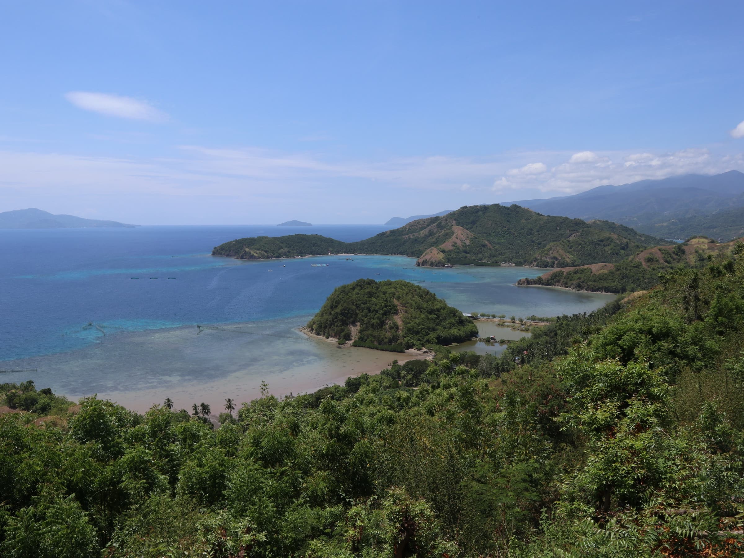
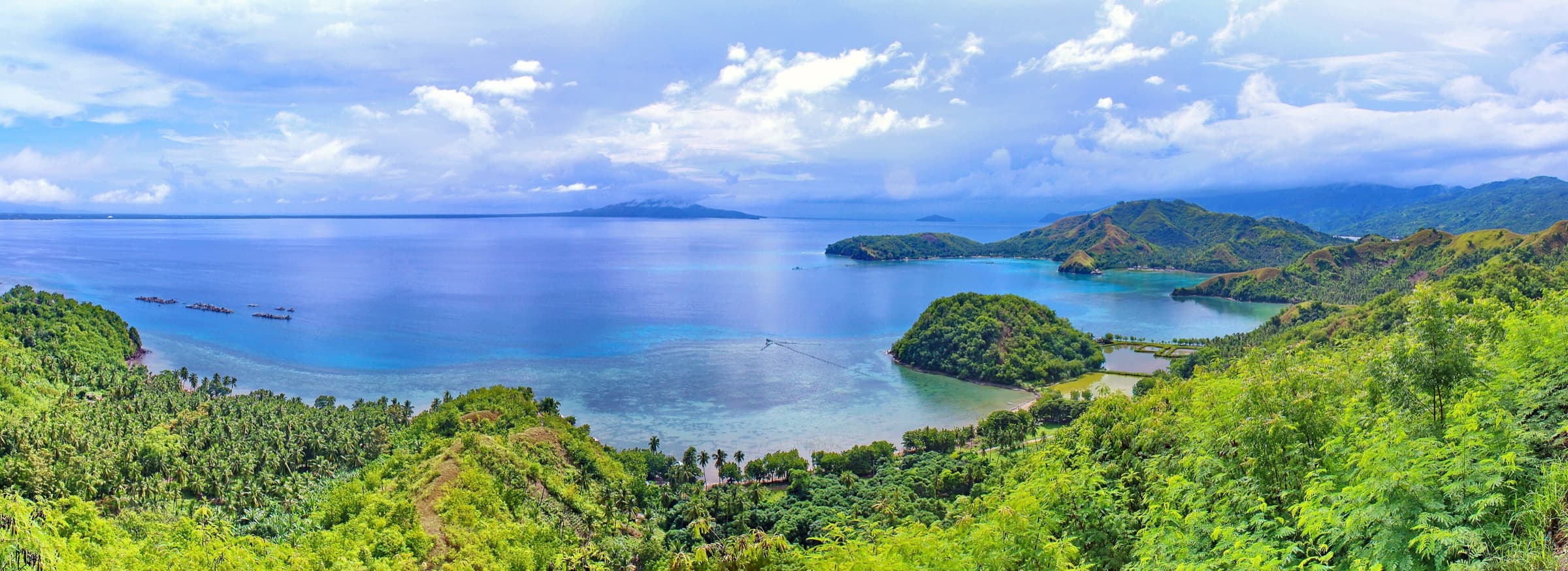
Wide panorama of a blue bay with green hills and a low, humped peninsula jutting into the water under scattered clouds.

Beaches and coastal destinations · Nature and ecotourism

Pujada Bay

City of Mati, Davao Oriental6.8914° N, 126.2272° EPublic record · pending validation

Photo: Michael E. Peligro · CC BY-SA 4.0

About this place

Description

The bay on which the City of Mati stands, enclosed by the Pujada and Guanguan peninsulas. It is a protected landscape and seascape and, according to the provincial government, a member of the Most Beautiful Bays in the World club.

Wikipedia describes Pujada Bay as an arm of the Philippine Sea with Mati's port and city proper at its head, Pujada Island at its mouth, and three smaller islands (Uanivan, Oak and Ivy) inside. It was declared the Pujada Bay Protected Landscape and Seascape, covering 21,200 hectares, through Proclamation No. 431 of 31 July 1994.

A provincial government post reports that the bay was admitted to the Most Beautiful Bays in the World club at the 15th World Bays Congress in Toyama, Japan, five years after Mount Hamiguitan's World Heritage inscription.

The 'Sleeping Dinosaur' promontory is the bay's best-known viewpoint (see separate entry). Island-hopping operators, fees and marine-protected-area rules should be confirmed with the City of Mati.

Sources: PIO post 'Pujada Bay is Now Among World's Most Beautiful Bays' (archived); Wikipedia: Pujada Bay.

Gallery

Photographs

Select a photograph to view it larger. Each carries its photographer credit and licence.

  • Sleeping Dinosaur landform and Pujada Bay (panorama). Location as stated by the uploader on Wikimedia Commons; not independently verified.

    Photo: Michael E. Peligro · CC BY-SA 4.0

Plan your visit

Getting there and what to expect

Location and map

Destination
Pujada Bay
City or municipality
City of Mati, Davao Oriental
Coordinates (WGS 84)
6.8914° N, 126.2272° E

The map shows the recorded point and the boundary of City of Mati. It is a locator, not a navigation aid.

Show or hide map layers

Directions

Directions — awaiting official content

Responsible office
Provincial Tourism Office
Required source
Route, road condition and transport information confirmed by the Provincial Tourism Office

Visitor information

Visitor information — awaiting official content

Responsible office
Provincial Tourism Office
Required source
Current opening hours, fees, booking rules and operating status of the site

Available facilities

Available facilities — awaiting official content

Responsible office
Provincial Tourism Office
Required source
Site facility inventory from the Provincial Tourism Office or the managing body

Responsible tourism guidelines

Site-specific guidelines — awaiting official content

Responsible office
Provincial Tourism Office
Required source
Site rules issued by the managing body or protected-area management board

Province-wide responsible travel guidance

Contact details

Contact details — awaiting official content

Responsible office
Provincial Tourism Office
Required source
Current telephone number, e-mail address and office in charge of the site

Provincial Tourism Office

Verification and sources

Public record · pending validationFrom public records — pending official validation.

Source: PIO post 'Pujada Bay is Now Among World's Most Beautiful Bays' (archived) and 1 other public source — not yet validated by the Provincial Tourism Office. 'Waniban Island' could not be sourced under that spelling; Wikipedia lists an island named 'Uanivan'. Confirm the official spelling.Responsible office: Provincial Tourism OfficeLast updated:

Source retrieved on 2026-11-16.