
Nature and ecotourism · Beaches and coastal destinations
Sleeping Dinosaur
Photo: Patrickroque01 · CC BY-SA 4.0
About this place
Description
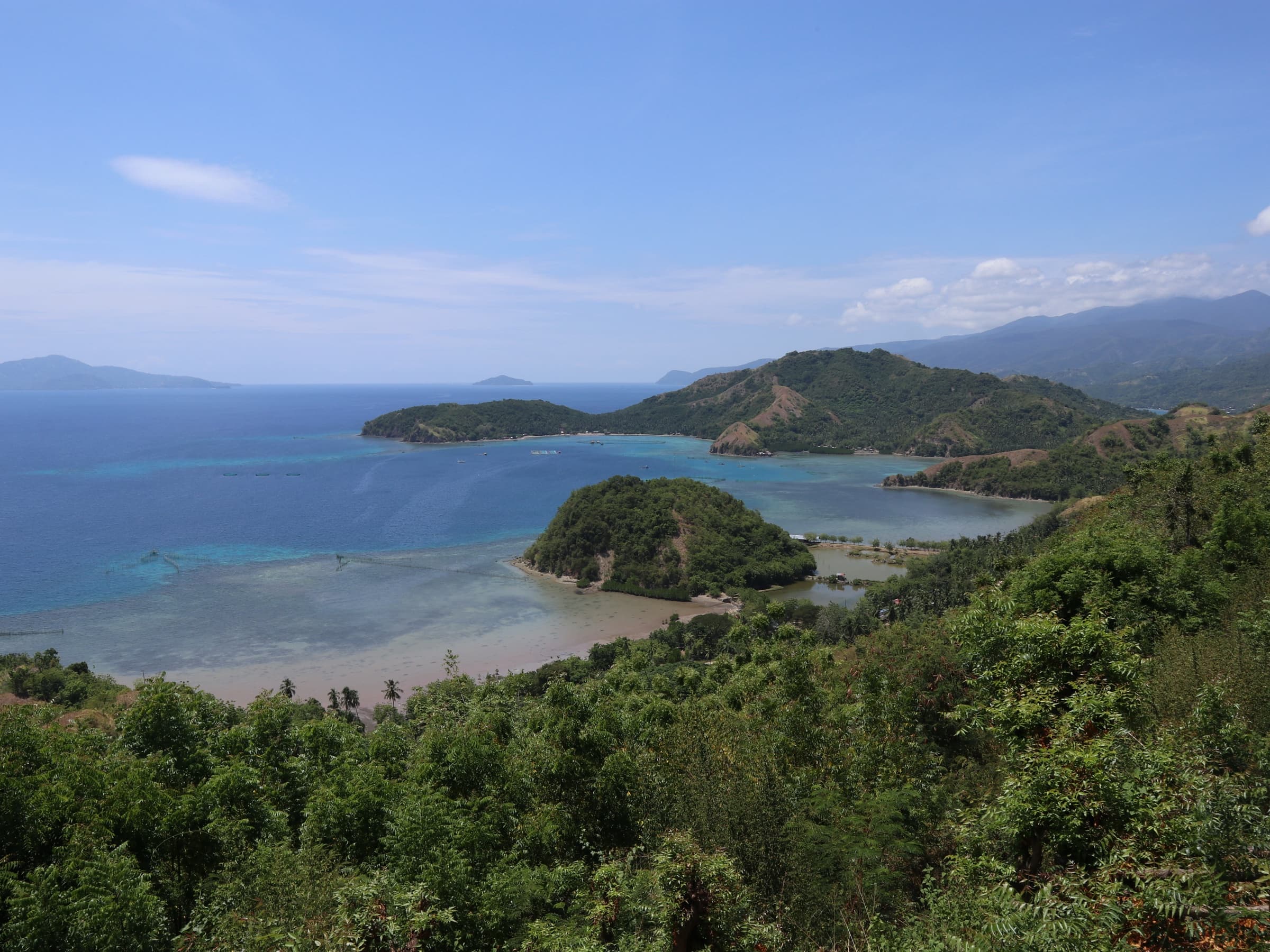
A promontory on the western shore of Pujada Bay whose outline resembles a reclining dinosaur. It is viewed from a roadside overlook on the highway approaching Mati.
A provincial government post on Pujada Bay describes the landform as a promontory 'locally known as Sleeping Dinosaur Island' because its shape suggests a reclining dinosaur, with Mount Bandera and Pujada Island visible beyond it.
Wikimedia Commons photographs place the viewpoint at Badas, City of Mati, and OpenStreetMap maps the locality in Barangay Mamali. Viewing deck facilities and any fees were not confirmed.
Sources: PIO post on Pujada Bay (archived); Wikimedia Commons category; OpenStreetMap Nominatim (coordinates).
Gallery
Photographs
Sleeping Dinosaur landform and Pujada Bay. Location as stated by the uploader on Wikimedia Commons; not independently verified. Photo: Patrickroque01 · CC BY-SA 4.0
Sleeping Dinosaur landform. Location as stated by the uploader on Wikimedia Commons; not independently verified. Photo: Joyfulwandering · CC BY-SA 4.0
Sleeping Dinosaur landform. Location as stated by the uploader on Wikimedia Commons; not independently verified. Photo: JuanPiso · CC BY-SA 3.0
Sleeping Dinosaur landform and Pujada Bay (panorama). Location as stated by the uploader on Wikimedia Commons; not independently verified. Photo: Michael E. Peligro · CC BY-SA 4.0
Trail along the ridge of the Sleeping Dinosaur landform. City of Mati, Davao Oriental. Photo: May Ann Libranda · CC BY-SA 4.0
Plan your visit
Getting there and what to expect
Location and map
- Sleeping Dinosaur
- City of Mati, Davao Oriental
- 6.8902° N, 126.1802° E
Directions
Directions — awaiting official content
- Responsible office
- Provincial Tourism Office
- Required source
- Route, road condition and transport information confirmed by the Provincial Tourism Office
Visitor information
Visitor information — awaiting official content
- Responsible office
- Provincial Tourism Office
- Required source
- Current opening hours, fees, booking rules and operating status of the site
Available facilities
Available facilities — awaiting official content
- Responsible office
- Provincial Tourism Office
- Required source
- Site facility inventory from the Provincial Tourism Office or the managing body
Responsible tourism guidelines
Site-specific guidelines — awaiting official content
- Responsible office
- Provincial Tourism Office
- Required source
- Site rules issued by the managing body or protected-area management board
Contact details
Contact details — awaiting official content
- Responsible office
- Provincial Tourism Office
- Required source
- Current telephone number, e-mail address and office in charge of the site
Verification and sources
Public record · pending validationFrom public records — pending official validation.
Source: PIO post on Pujada Bay (archived) and 2 other public sources — not yet validated by the Provincial Tourism Office. Barangay differs between sources (Badas vs Mamali).Responsible office: Provincial Tourism OfficeLast updated:
Nearby and related
Continue exploring
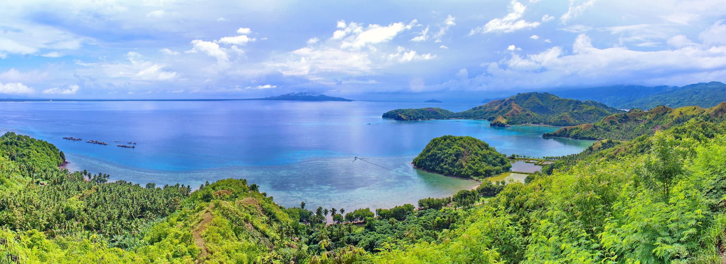 Beaches and coastal destinations · Nature and ecotourismPujada BayCity of Mati6.8914° N, 126.2272° E
Photo: Michael E. Peligro · CC BY-SA 4.0
Also in City of Mati
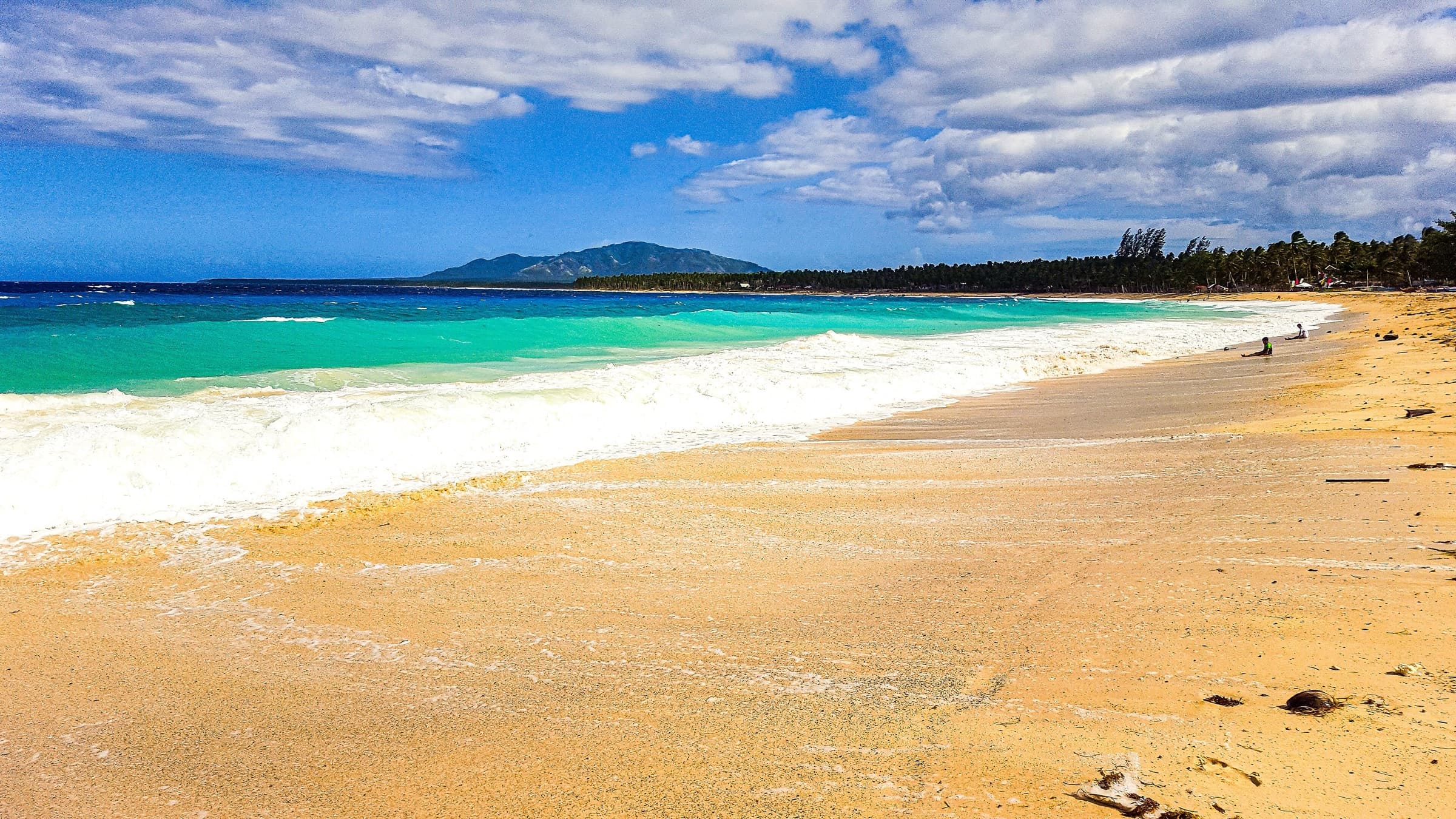 Beaches and coastal destinations · Adventure tourismDahican BeachCity of Mati6.9243° N, 126.2809° E
Photo: Joyfulwandering · CC BY-SA 4.0
Also in City of Mati
Nature and ecotourismMati Protected LandscapeCity of Mati6.9625° N, 126.2006° E No licensed photograph is registered for this destination yet. Also in City of Mati